Polski tekst jest jeszcze w opracowywaniu. Na razie dostępna jest tylko wersja angielska. Przepraszamy!
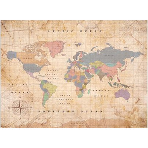
freytag&berndt Antique world map of John Speed 1651
This beautiful reproduction shows the antique world representation of the famous English cartographer John Speed.
John Speed originally published his world map "A New and Accurat Map of the World" in 1626, two years before his death. In 1651, however, it was reissued with some corrections.
The world map cost about 40 shillings at that time, so it was reserved for the wealthier society and for libraries.
Speed's maps were the base for almost all other world maps in the 17th and 18th centuries. Thus his contemporaries described him as the "British Mercator" with reference to the equally pioneering cartographer and globe manufacturer Gerhard Mercator.
The ancient world map is divided into the two hemispheres, a western and eastern one of a line through the Atlantic Ocean. Since the map dates from 1626, the proportions of the continents are of course very different from today's representation. Australia was sighted by Europeans for the first time only shortly before, but there were still no "certain" statements on cartography. Therefore no continent is drawn on Speed's map, but only the reference to "the Southerne Unknowne Land".
Typical in the maps of the world at that time are the decorations on the edges of the images. Thus there are allegories on the four elements water, earth, fire and air, as well as drawings on the insights into astronomical (and astrological) phenomena such as the planetary constellations, solar and lunar eclipses and the signs of the zodiac.
The colour scheme is deliberately kept in muted colours, although the original map was probably more colourful. But as a typical antique style this fits wonderfully to the vintage character of this detailed and historical world map.